Tuesday, May 31, 2016

Days 28-29, May 28-29, 2016 Saturday & Sunday Muncho Provincial Park, BC – Watson Lake, YT – Teslin, YT

Crossing the HUGE Liard River
“Thousands of tired, nerve shaken, over civilized people are beginning to find out that going to the mountains is going home. The wilderness is a necessity.”   John Muir

Where there are towns there are amenities…and humanity’s footprints.
All started by an Illinois soldier
Signpost Forest
We have passed through seemingly infinite unspoiled boreal forests filled with game, songbirds, and unimaginable river corridors.  We have become accustomed to this and now it’s becoming a bit of a shock when we arrive in the small outposts of humanity.  For the most part, well kept, they seem out of place compared to nature’s unblemished continuity.  This said, without them this trip would be impossible.  How would one cross the vast expanse of the Laird River…seeming as big as the Mississippi but coursing through wilderness?  How in the world did one cross such obstacles in days past?  Between the muskeg, streams and rivers it seems that only winter would give such watery byways any sort of footing on which to navigate.  The mild season offers continuous bogginess which would mire man, beast, and machinery.  I have a much deeper appreciation for what the builders of the Alcan Highway faced.
Carrying on the Tradition

Watson Lake offered internet, telephone service, showers, a laundromat and a visit to the “Signpost Forest.”  It is here that folks from all over the world bring signs, hang them on posts to mark their visit to this part of the world.  We were no exception, carrying one our elder daughter’s old personalized license plates (SPEERJ), we nailed it at a prominent spot on one of the sign posts.  This tradition was all started by a lonely Illinois GI working on the Alcan Highway in 1942 who posted a sign denoting the distance to his home in Danville and has carried on to this day. 

While nice to clean up and check-in with family, one night was enough.  We started off on Hwy 97 and connected to Hwy 1 at the Yukon Border where we crossed and re-crossed back and forth between British Columbia and the Yukon until arriving in Teslin at kilometer 1244.  Any thoughts of bicycling this route were put to rest by the numerous bear (both black and brown) that we encountered on this route.  Many were right alongside the road chomping away at plants…until something more appetizing might come along.


Bison alongside the road
On the way we crossed the continental divide at kilometer marker 1120 where “two of the largest watersheds in North America” the Yukon and Mackenzie watersheds take their separate journeys to the sea, one to the Bering Sea and the other to the Beaufort Sea.  As we passed over the divide, we experienced rain, rain mixed with snow and those passing after us were delayed when snow closed the road.  On we drove until we arrived at Teslin Lake Provincial Park where we spent a rain filled night in a beautiful campground.  The next day it was then off to Whitehorse where we will spend several days exploring, resting, and deciding on our next move.
They even bring their friends!
Bear seem to be EVERYWHERE!


And they are BIG!!


The road continues North
Flowers abound in Teslin

Home for the night in Teslin

Days 25-27, May 25-27, 2016 Wednesday - Friday Buckinghorse River Wayside Prov. Park, BC – Muncho Provincial Park, BC

Caribou right in front of our RV
“My biggest worry is that my wife (when I’m dead) will try to sell my fishing gear for what I said I paid for it…”  Koos Brandt

The Wilds of British Columbia
Not always paved!
Leaving Buckinghorse we continued north on Hwy 97 through Prophet River until we arrived at Fort Nelson, British Columbia.  On the Alaska Highway, mile markers (Mile Posts) are the main designation for sights of interest.  Due to modifications on the highway, sections have been shortened over the years so these designations may no longer be accurate.  This being the case, distance can be noted as “Mile Post,” “Historical Mile Post” (original distance) or in today’s metric age “Kilometer Post” in travel brochures.  Milepost, one of the “must have” Alaska Travel Planners uses all three at one time or another.  Fort Nelson, once a timber town, now focuses on petroleum resources as well as tourism.  It was here that I purchased my British Columbia fishing license…like lottery tickets, some are lucky and some are a bust…mine was a bust.  Seems that the grayling, 20-pound lake trout or the huge Northern Pike were all on holiday as I received nary a nibble.  Maybe the Yukon Territories will be my “lucky number.”  Can’t be a skill thing…can it?

Anyone for a walk?
Milepost, rather unfairly, notes that Fort Nelson has the highest fuel prices along the Alaska Highway.  Not so!  We paid $5.10 (US)/gal, at Northern Rockies Lodge in Muncho Provincial Park, BC.  While high, fuel in Fort Nelson was $3.75 (US), reasonable considering its remoteness.  This cost was easily offset by the community hosting a rest stop for travelers that offers free water fill-ups and free dump stations for RVers.  They really cater to the traveler and the residents were friendly and helpful.  Speaking with several residents, we found a deep love of community, the North, and the lives they lead.  While chuckling about the winters, not one we spoke to seemed to have any interest in relocating south…” vacationing YES, living “NO!”


Bison on the Road
From Fort Nelson it was on to Muncho Lake in Muncho Provincial Park in British Columbia. Muncho Lake was so beautiful that we decided to set up camp for three nights at Strawberry Flats Campground.  On a sunny day (none to be had while we were there) the lake takes on a vivid almost unreal blue that is said to be enhanced by copper oxide leached from the surrounding mountains.  It is suspended in the water, albeit, at very low levels.  This area, while not only beautiful, abounds with wildlife.  Stone Sheep, Moose, Caribou, a myriad of predators and the ever present bear (both black and grizzly) that gives one pause while hiking.  I hiked once by myself…didn’t feel comfortable at all but took a later and longer hike with a couple from San Diego (Gerry and Karen Brewster) and that was a lot of fun.  We hiked a portion of the “old Alcan Highway” and had a great view of Muncho Lake.  Rained most of the time we camped but we were snuggly warm in our RV…sorry to say that due to the rain our solar panel didn’t operate optimally so we had to use our generator more than we liked.  It’s been a great trip so far.  We have seen a LOT OF BEAR from the car but have not made our acquaintance on the trail so far…let’s keep it that way.


And what a road it is...from this...

...to this!

Days 23-24, May 23-24, 2016 Monday & Tuesday Grande Cache, AB – Kiskatinaw Prov. Campground, BC – Buckinghorse River Wayside Prov. Park, BC

Section of the Old Alaska Highway
“She turned to the sunlight…And shook her yellow head, And whispered to her neighbor:  “Winter is dead.’”  A.A. Milne

Land of the “Midnight Sun”
Our travels have taken us steadily north and the days are becoming increasingly longer.  Going to bed at 9:30 PM does not necessarily offer darkness.  Anticipating this, after living and experiencing long days in Canada, Andrea made blackout curtains that we can roll down over our windows at bedtime.  This, coupled with a darkening pad for our semi-transparent roof vent, offers us seemingly nighttime darkness.  The only problem is that, cozy as it is in our nest, getting up in the morning tends to be rather on the late side.  Soundly we sleep!
 
Humm....
Leaving the wilds of Grande Cache, we transitioned from Hwy 40 to Hwy 97 into the flat-lands of Grande Prairie.  Oil, natural gas, and agriculture invigorates Grande Prairie’s economy and it was here that we found all the amenities of a thriving community.  After adjusting to the wilds of Canada, a modern city was quite a shock.  We did our shopping and left town post haste.  Once on the road, we continued northwest to Dawson Creek, BC and it is here that the Alaska Highway is the designated starting point…MILE ZERO at Dawson Creek. Named after George Dawson who surveyed the area in 1879, its agricultural heritage remains a part of its economy but natural gas has supplanted its footprint on the economy in a big
Kiskatinaw River Bridge was an Engineering Challenge
way.  Just to the northwest we set up camp at Kiskatinaw Provincial Campground that sits below the historic Kiskatinaw River Bridge that curves over one of the first obstacles that Army Engineers encountered when building this WWII highway.  It is here that a side loop of the “Old Alaska Highway” allows the traveler to view this historic site.  At this small, scenic campground we observed beaver playing in the river but remained vigilant as bear and moose are plentiful in the area.  This will remain a constant as we continue north.


Beaver below the Bridge
We awoke to clear skies and after a good breakfast we were on the road heading to Fort N
Kiskatinaw Bridge
elson, BC and once again enjoying the remoteness that the Great North offers.  Coursing through great forests of conifers and deciduous trees we took our time, enjoyed the wilderness, and watched for game.  Sadly, the first moose observed on this trip was one that had been hit and killed laying alongside the road.  Game is VERY THICK along Hwy 97 so caution and slower speeds were the order of the day.  At approximately 180 miles into the Alaska Highway, we stopped to spend the night at Buckinghorse River Wayside Provincial Park.  Off the road, rustic, and nestled alongside the Buckinghorse River, we had the campground to ourselves.  It is here that grayling abound but alas, while well stocked with fishing gear, fishing licenses were acutely in short supply.  DARN!!

Watch out for Wildlife!


Highway going North
Stephan!!...are you sure there are no bear here? 


Monday, May 23, 2016

Day 21, May 21-22, 2016 May-Long Weekend Jasper National Park – Grande Cache, Alberta (Smoky River Region)

Birthday Pie...68th birthday
“The Aboriginal people gave the Smoky River its name because lightning would sometimes start the exposed coal seams on the banks on fire, so they would smoke.” Grand Cache Historical Society Brochure

On the road to Grande Cache

Alberta Hwy 40, like so much of Canada, was a wilderness dream to travel.  We observed our first caribou just south of Grande Cache, a thrill to say the least, and deer abounded.  A well paved two lane road, Hwy 40 coursed through deep valleys, over steep mountains, and as we drove the view from our windows presented an ever-changing mural of nature’s bounty.  Encountering snow, we took our time, enjoyed the scenery and marveled at how fortunate we were to be able to have the time and resources to travel on such a fantastic journey.  Arriving in Grande Cache, we just did not want to glide through such a beautiful setting without exploring this once in a lifetime opportunity.

Caribou along side the road...late migration
Grande Cache displays wilderness at its best.  Picturesque, it rubs elbows with the Willmore Wilderness Park and is teaming with wildlife.  Stopping at the Tourism & Interpretative Centre, we met Jim Merrithew, Supervisor of Tourism & Culture, who dropped all that he was doing to advise us on the best “must see” trails, waterfalls, and points of interest.  He was a wealth of information on the archeological, geological, and anthropological history of the area.  Traveling at “paved-road speeds,” Grande Cache might seem just a wide spot in the road but one could spend a month here and never see all that the area has to offer.  This is one of those “treasures laying between destinations where adventure is to be found.”  If Alaska is beyond your reach, the next best alternative, in our opinion, would be to visit Banff National Park and Grande Cache.

Taking in the scenery and hiking along the Smoky and Sulfur Rivers became our objective while in Grande Cache and we were not disappointed.  Admitting that the abundance of bear warning postings took their toll on our intrepidness, for the most part we forged ahead.  This said, we saw no bear scat nor signs on our walks…to say that we were pleased would be an understatement.  Hiking to the confluence of the Smoky and Sulfur Rivers, we were able to stand on platforms overlooking this gorgeous spot.  
"What!!  Grizzlies climb trees?"
While there we met a Canadian couple from the area.  They spoke of how their father ran a trap line in the Willmore Wilderness upriver from where we were standing but he was pondering that it might be time to pack it in…he is 82!!  I love these people.  They know no limits and live life to the fullest!


Spending my 68th birthday in Grande Cache among people who have a vivacity for life, love where they live and feel no compulsion to pattern their lives as dictated by society’s norms was a fine gift indeed.  Sharing this with Andrea made it all the better.

Smoky River


Snow on the way to Grande Cache


Trail to Muskeg Falls


Sign on trail to Muskeg Falls
Confluence of the Smoky and Sulfur Rivers near Grande Cache

Sulfur River

Andrea,,"Are you sure there are no bear here?"


Day 20, 2016 – Friday Yoho National Park – Banff National Park – Jasper National Park

When I’m in Canada, I feel this is what the world should be like.”  Fresh Quotes
Near Banff

Banff to Jasper Highway

Banff to Jasper Highway
The Banff to Jasper Highway has never failed to conger a mixture of wonder and awe in all who venture forth on this two lane road that parallels the Canadian Rockies’ Continental Divide. “Promenade des Glaciers” as Hwy 93 is called by French Canadians is featured in National Geographic’s Drives of a Lifetime.  This highway, completed in 1940, displays nature at its best!  Spectacular Alp like summits slammed into the heavens by gigantic forces freefall into colossal valleys below scooped out by glaciers and roaring emerald teal rivers is too stunning to fully comprehend.  One vista after another keeps knocking the traveler back on their heels and this goes on for 140 miles.  We have beat the busy tourist season where in July and August the forest service reports more than a 100,000 vehicles traverse this highway on a monthly basis.  Teaming with wildlife, travelers can expect to see elk, bighorn sheep, bear and the myriad of other creatures that call this wonderland home.  Having traveled so many beautiful spots around the world, this, in my opinion, is the most wondrous sight on earth.  Having taken this drive dozens of times while living in Canada, I am never less than awestruck with each visit and ALWAYS discover something that I failed to observe on an earlier trip.  If given only one day left in your life…spend it here.  It surely is natures path to Heaven.

Bighorn Sheep along the Road


Banff to Jasper Highway

Athabasca River near Jasper
Steve,at home and taking it all in.
Bear Crossing Road Near Jasper

Sunday, May 22, 2016

Days 17 - 19, 2016 – Tuesday - Thursday Potlatch, Idaho – Yoho National Park

Idaho Panhandle
“The proper function of man is to live,
 Not to exist;
 I shall not waste my days in trying to prolong them;
 I shall use my time.  Jack London

Potlatch to Coeur d’Alene, Idaho
We are running out of adjectives to depict the beauty of all that we are seeing.  Idaho’s Panhandle area with its rich forests and stunning mountains, British Columbia, and Alberta’s Rocky Mountain region with its soaring crags, surging rivers, and abounding wildlife defy description.

Crossing into Canada
Traveling Hwy 95N from Potlatch we came to Coeur d’Alene and were stunned to discover that with less than 50,000 residents it offers more amenities than anything that we could hope to have in our little town of Decatur, Illinois.  Progressive, beautiful, and clean, it radiates pride in ownership.  People living there love it and are quick to share what they love about it.  Great shopping, affordable housing,  
College/University setting, top notch medical services, low property taxes, recreation, and its proximity to travel hubs endears it to old and new residents alike.  It will definitely be on our list for a revisit.

Canada
Back to Canada via East Gate, north of Bonners Ferry, brought back memories of when we lived in Canada in the 80’s and 90’s.  As dual citizens, there was no need to have our passports stamped.  We just slipped in easy as could be…everyone does, citizens or not.  The border guards were very nice, as always, and wished us safe travels.  Question:  Does Canada have a queen?
  You betcha!  Who is it?  We will let you look this one up.
 
Canadian Rockies
Onward north on Hwy 95 with the scenery becoming ever more stunning with each mile.  Gassing up in Cranbrook and exchanging US for Canadian funds we were again on the road until we reached Wasa Provincial Campground where we spent the night.  Rain…Hail…Rain!!! but we were snug as bugs in our nice warm RV.  What a great way to travel!  The next morning we hiked on an interpretive trail that described how this part of the terrain is within a “rain shadow.”  Hard concept to grasp while getting rained on.  It was a beautiful hike nonetheless.
 
"Oh Canada..."

Andrea out for her morning hike
Next morning it was off Yoho National Park in British Columbia.  “Yoho” is a Cree expression meaning “awe and wonder” and most certainly the landscape did not fail to live up to this expression. Continuing on to Golden, British Columbia and then into Yoho we spent the night in Monarch Campground.  Here we were surrounded by towering snowcapped mountains that reached up into the clouds and beyond.  Our campsite was stupendous!!  Faced with simply homesteading and building our “dream log cabin” or moving on, we chose the latter the next morning.
Why is everything so green?
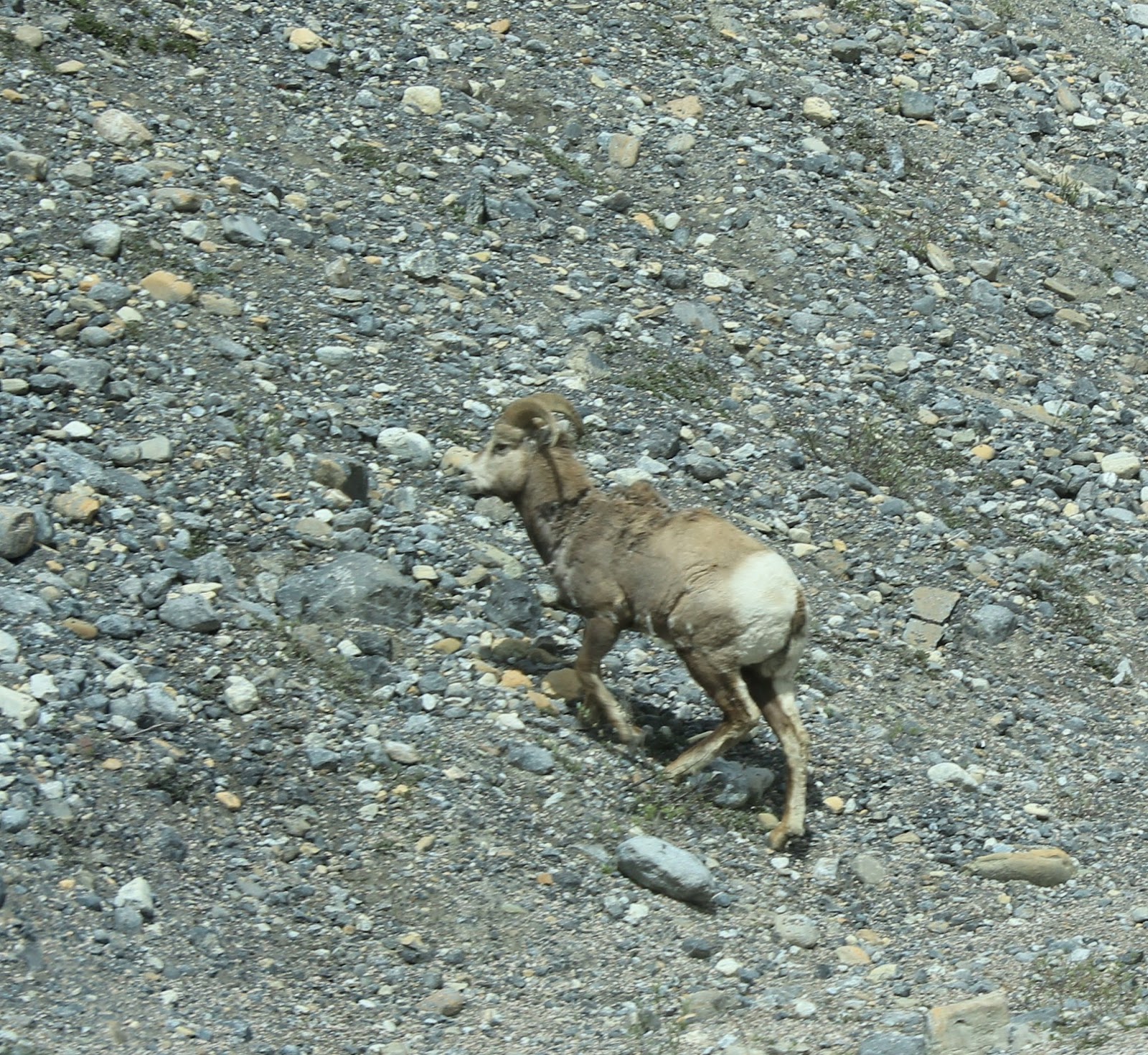
Morning Visitor

Beauty Abounds